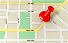
 Geocoding is the process of assigning location to information. In the context of a Geographic Information System (GIS), it means assigning geographic point coordinates to a street address.
More generically, it can mean taking any data with textual descriptions of town, zip code, or country, for example, and making it mappable. Relating county data to the geographic boundaries describing counties is a form of geocoding, but geocoding usually implies mapping more specific location information, such as residential addresses.
Geocoding is important to public health tracking because it tells us where disease, select populations, environmental problems, or other health-related factors concentrate geographically.
Geocoding childhood lead poisoning data, for example, tells us what areas of the state have the highest rates of lead poisoning. Public health professionals at Maine CDC and its partners use addresses of lead poisoned children to identify specific neighborhoods in need of further resources to prevent lead poisoning.
Another example is mapping household well water tests in order to locate hotspots of arsenic, uranium, radon or other water contamination issues.
The most reliable reference source for geocoding in Maine is "E911", or Enhanced 911 data. These are geographic files of streets and addresses generated by each town to support 911 emergency services.
The Maine CDC Environmental Public Health Tracking Program funded an effort to create direct access to these data for the purpose of geocoding. Large lists of addresses can be processed efficiently by this service on behalf of Maine CDC employees, without the need for running or configuring complex GIS software.
The geocoding service is publicly available at Maine GeoLibrary.
In Maine, every town has a state-assigned 5-digit code called a "Geocode". This is neither a zipcode, nor is it related to the process of geocoding. Beware the difference between data that "has a Geocode" (a town code) and data that are geocoded (has point coordinates, in the form of latitude/longitude).