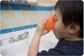
More than half the people in Maine get drinking water from private, residential wells. Many Maine wells have too much arsenic or other contaminants of concern. Tracking private well water data can help form a better understanding of what parts of the state may be at higher risk for well water contamination.
What data are available?
Maine tracks the following measures associated with Private Well Water:
Well Water Use and Testing Behavior
Water Quality
Well Water Use and Testing Behavior
These displays present information on the percentage of adults ages 18 and older with well water, and whether they tested their wells as reported through the Behavioral Risk Factor Surveillance System, a telephone survey. Data is based on a yes response to: "Do you get any of your water from a well?" (Well Water Use), and, if yes, "Have you ever had your well water tested?" (Any Test) and "Arsenic is not included in all water tests. Have you tested your well water for arsenic?" (Arsenic Test).
Water Quality Testing Results
These displays present information from thousands of private well water samples analyzed at the State of Maine Health and Environmental Testing Laboratory, summarized by town and county. Maine's Maximum Exposure Guidelines: Arsenic: 10 ug/L (micrograms per liter), Chloride: 250 mg/L (milligrams per liter), Fluoride: 2 mg/L, Manganese: 0.3 mg/L, Nitrate: 10 mg/L, Nitrite: 1 mg/L, Uranium: 30 ug/L.
Town-level Data:
County Comparison Maps:
Well Water Tables
Create a custom table of data about well water use and testing behavior or well water quality.
Measure Definitions
Well Water Use and Testing Behavior
Data represent the estimated percent of Maine adults (age 18+) who have well water, have tested their well water, and have tested their well water for arsenic, as reported by the Behavioral Risk Factor Surveillance System (BRFSS), a randomized telephone survey.
The maximum level is the highest test result in the dataset measured in a given geographic area (Town, County, or Public Health District).
The median is the contaminant level in a given geographic area (Town, County, or Public Health District) that represents a middle value, for which about half (50%) of the test results in the dataset for that area are higher, and half (50%) are lower. For towns with less than 20 wells tested, this calculation is considered unstable, and results are not displayed.
The 95th percentile is the contaminant level in a given geographic area (town, county, or Public Health District) for which 5% of the test results in the dataset for that area are higher, and 95% are lower. For towns with less than 20 wells tested, this calculation is considered unstable, and results are not displayed.
For analysis results below the limit of detection (LOD), we substituted half the LOD. Limits of detection may vary somewhat based on analysis method, analysis date, or sample dilution, but the current LODs are: Arsenic: 0.5 ug/L; Chloride: 1 mg/L ; Fluoride: 0.1 mg/L; Manganese: 0.0005 mg/L; Nitrate: 0.05 mg/L; Nitrite: 0.05 mg/L; Uranium: 0.5 ug/L.
Data Limitations
Well Water Use and Testing Behavior
Maine adults who are institutionalized, do not have a phone, or are unable to communicate are not represented.
Statistical weights are used to calculate prevalence estimates in order to be more representative of the general adult population in Maine and to adjust for non-response, though weighting methods are not perfect in accomplishing this. In 2015, weighting methodology changed to include cell phone and landline respondents. Changes in prevalence estimates may be partially related to changes in weighting practices.
Water Quality
Data only represent water samples tested by the State of Maine Health and Environmental Testing Laboratory (HETL). These data may not be representative of well water quality across the entire state. Summaries are not given statewide; combining all the results would not create a representative summary for the state as a whole.
Data are subject to selection bias, as they are based only on well owners who decide to test their wells. For contaminants that cluster spatially, such as arsenic and uranium, the "hot spot" areas may have higher testing
rates - and therefore, the percent of wells in these areas that exceed the state guideline is likely to be biased upward, and not reflect the true percent that actually exceed the guideline.
You found it!!
Published April 23, 2014
Where can I find more information about Private Well Water?